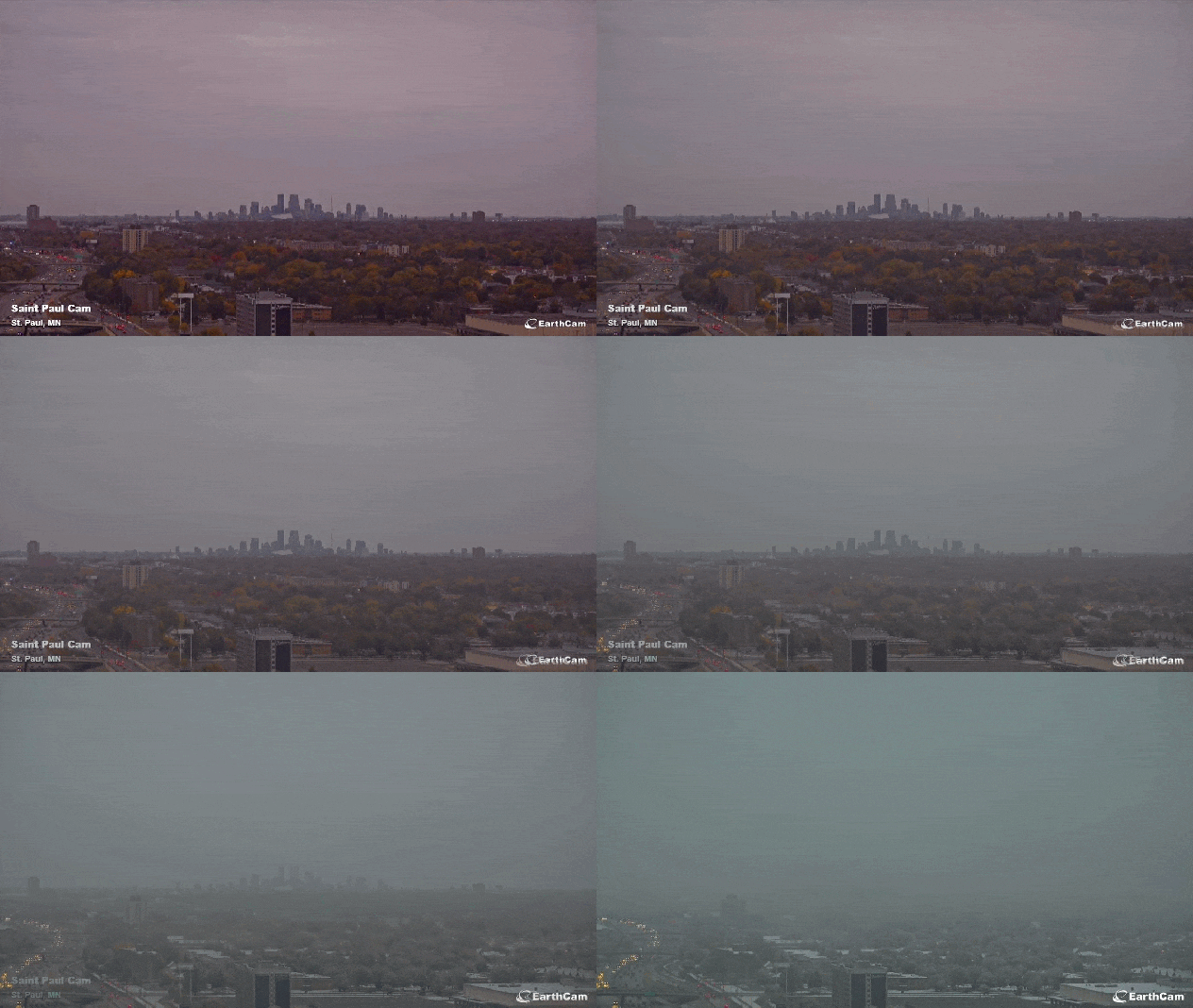
Early-season Snow Seemingly Transforms Fall Into Winter Within A Day

Winterlike scenes unfolded across portions of Minnesota and Wisconsin on Friday morning as many residents woke up to fresh powder. For some areas, Friday marked the first accumulating snowfall of the year as some of the coldest air of the season so far sent temperatures tumbling.
Reports of accumulating snow poured in from much of Minnesota and northwestern Wisconsin as the sun rose on Friday. Residents of Minnesota’s Twin Cities of Minneapolis and St. Paul stepped outside to a general half of an inch to 1 inch of fresh snow. Farther north, around 2 inches of snow blanketed portions of Duluth.
Meteorologists at the National Weather Service in Duluth kept a watchful eye in the earliest hours of Friday morning as snow began to accumulate on grass and unpaved surfaces. By the time snow came to an end, NWS meteorologists had recorded 1.8 inches of snow and built a new office mascot.
“Great snowman snow out there!” the NWS office said on Twitter Friday morning.
Great snowman snow out there! We officially have 1.8″ in Duluth! pic.twitter.com/JUzQQipf7n
— NWS Duluth (@NWSduluth) October 14, 2022
Elsewhere across the state, traffic cameras showed a generous coating of snow on the grassy shoulders of area highways and interstates as trees glittered with freshly fallen flakes clinging to leaves and branches.
Fortunately, for many travelers, roadways were mainly wet as paved surfaces remained well above freezing or subfreezing levels, giving the snow no real chance to accumulate on the highways.
In terms of temperatures, Minneapolis and Duluth are running 3.7 and 2.0 degrees above average, respectively, so far in the month of October. AccuWeather meteorologists say both soil and paved areas have thus far been unable to shed their built-up heat storage as chilly spells across the region have been brief this season.
The mid-October snowfall seemingly transformed scenery from fall to winter within a day, creating beautiful sights for those who are fans of winter weather but also stirring up some strong emotions for people who can’t stand the cold and snow.

A meteorologist from the NWS Duluth office was feeling the winter vibes and tweeted out about how it was going with taking hourly snow measurements. “I had to break out the hot cocoa with all the hourly snowfall updates,” the tweet read, and it went on to say, “It was getting chilly with all the snowflakes sticking to my sweater.”
As residents sent in snow measurements, a few shared some beautiful photos of the snowy landscape.
One social media user replied to the NWS office, tweeting opposite sentiments on the snow, “Good Heavens NO. I’m so grateful I am not living in MN anymore.”
Accumulating snow at this point of the autumn season is not unusual in this part of the country. The Duluth area, for example, typically records its first measurable snowfall of the season around Oct. 24. Meteorologists define measurable snow as amounts greater than or equal to 0.1 of an inch.
While Duluth may be slightly ahead of schedule this year, Friday’s snowfall is far from the earliest flakes to accumulate on record for the city. The earliest that an inch or more of snow was ever recorded in Duluth occurred on Sept. 18, 1991, when 2.4 inches fell, according to AccuWeather Meteorologist Matt Benz.
Farther south, accumulating snow in Minneapolis is a few weeks ahead of schedule. The city typically records its first measurable snow around Nov. 4. However, Friday’s snowfall was quite tame compared to the amounts Minneapolis has had to deal with in recent Octobers.

“Minneapolis picked up 7.9 inches of snow on Oct. 20, 2020,” AccuWeather Meteorologist Brandon Buckingham noted.
If this same event had occurred in September, it would have been highly unusual.
“In the last 15 years, there have been no September snow events recorded at the reporting station on the grounds of Minneapolis-St. Paul International Airport,” Buckingham said.

In fact, AccuWeather forecasters say some of the coldest air of the season so far is expected to rush across the North-Central and Midwestern states early next week as Arctic air plunges south out of Canada.
Produced in association with AccuWeather.
The Western Journal has not reviewed this story prior to publication. Therefore, it may not meet our normal editorial standards. It is provided to our readers as a service from The Western Journal.
Truth and Accuracy
We are committed to truth and accuracy in all of our journalism. Read our editorial standards.
Advertise with The Western Journal and reach millions of highly engaged readers, while supporting our work. Advertise Today.


